
How to use the subway map?
Updated 2026-08-18
Where is the metro map feature and what can it do?
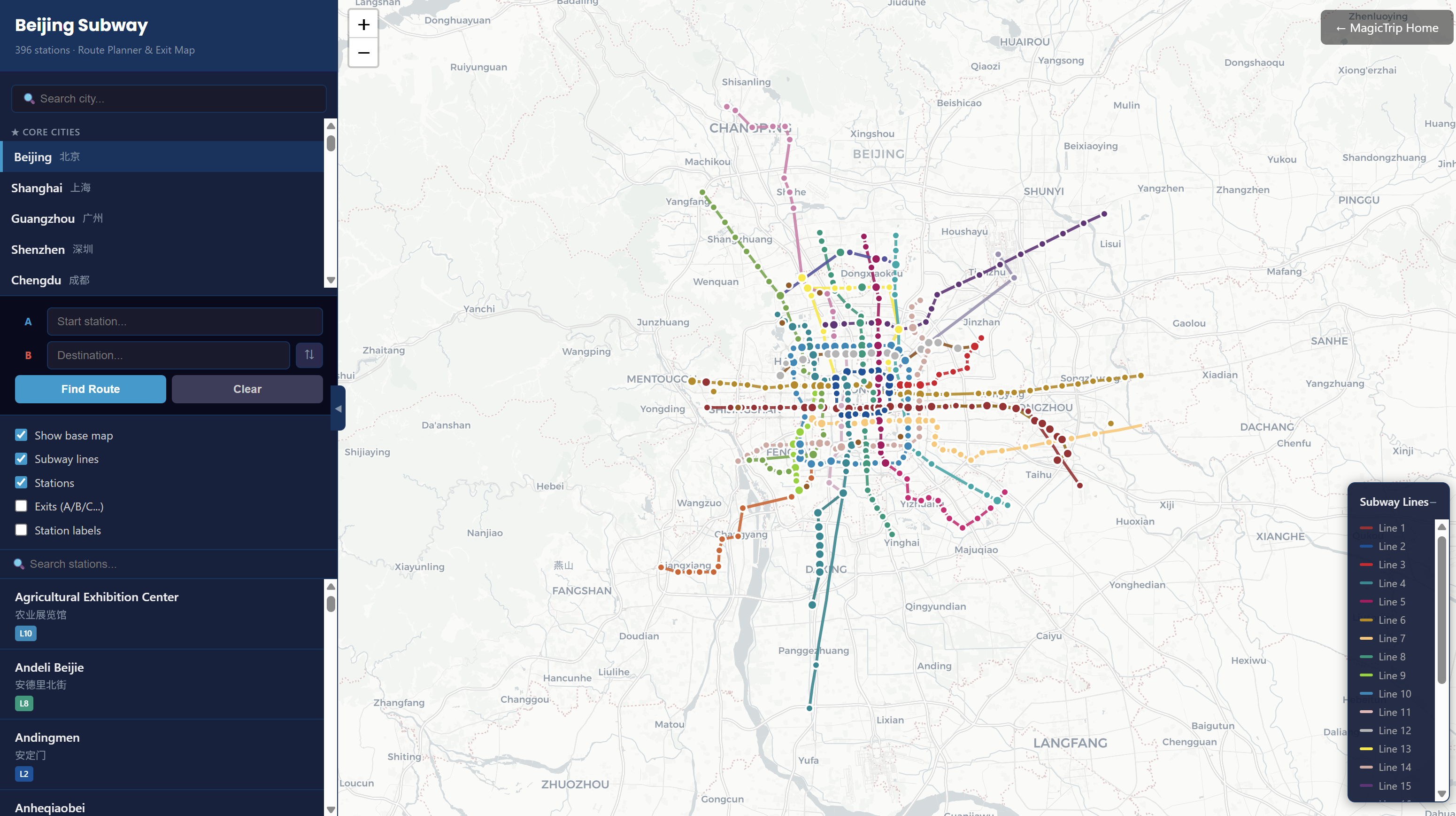
The subway map is an interactive metro planner for 40+ Chinese cities — lines, stations, exit numbers, and route finding on one map.
Opening it
Open Subway Map from the navigation — the map loads with Beijing by default.
Choosing a city
Use the city selector at the top of the sidebar to switch cities. Each city loads its own metro network automatically.
Planning a route
The sidebar's Route Planner finds the fastest way between two stations:
- Type a station into A — Start station (suggestions appear as you type).
- Type another into B — Destination.
- Click Find Route.
The result shows the path on the map with your transfers. Use ⇅ to swap A and B, and Clear to start over.
Exploring stations and exits
- Click any station on the map to see its line connections.
- Turn on Exits (A/B/C...) in the layers panel to see each station's numbered entrances — useful when you're meeting someone "at exit C".
- Search for a station by name with the Search stations box; the results list jumps the map to your choice.
Controlling the layers
The sidebar has five toggles:
- Show base map
- Subway lines
- Stations
- Exits (A/B/C...)
- Station labels
Turn layers off when the map feels busy — keep lines + exits on when navigating for real.
Small things worth knowing
- The ◀ button collapses the sidebar to give the map more room (click again to bring it back).
- The line legend on the map lists every line's color and number; click its header to fold it away.
- The map works on phones too — handy while you're actually standing in the station.
The subway map is free for everyone.
Watch the subway map in action
The sidebar controls — lines, stations, and toggles:
Locating a station on the map:
Opening a station to see its exits: